Burke's Garden:
God's Fingerprint
A brief overview of the geology and history of the region.
Burke's Garden has a unique geology and history that is rare in its region. As you can see, it looks like a crater in the earth, almost like a hollowed-out bowl of earth. But yet, it isn't filled with water and has supported a thriving community over the years. How did such an odd formation form? Was it a volcano, a meteor impact crater, or something else entirely
The makeup of this region plays a large role in why Burke's Garden was formed the way it was. The limestone in this region dissolves with time when it comes into contact with water, creating large caves and underground streams and creeks. The layers you see below arch up and then are eroded away to form what we know as Burke's Garden.
Geologic Profile:
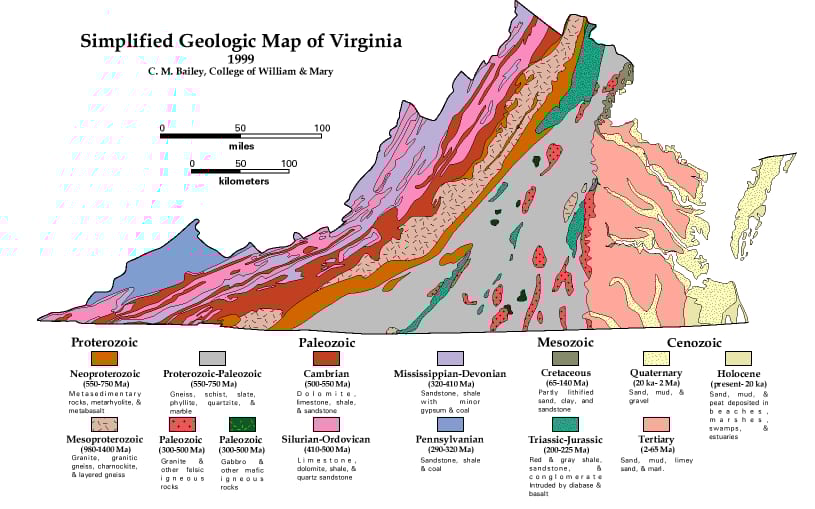
For this region, much of the layers are made of limestone and layers of siltstone. This is known as the limestone karst region. This geological layer forms the majority of this region's topography.
Layers of rock that make up Burke's Garden
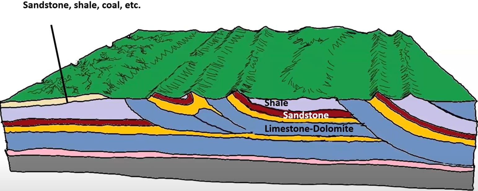
Below, you can see the layers that will make up the formation start to move upward in the crust and form the shape of Burke's Garden as we know it
Beginning of Burks Garden
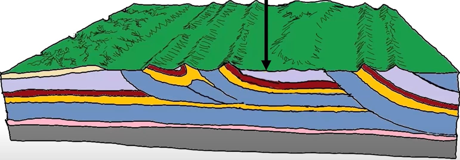

Early stages of Burk's garden
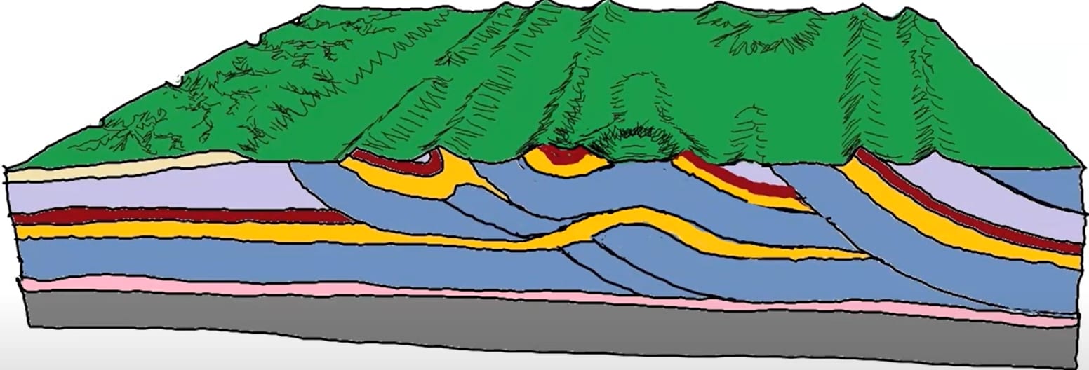
Below, the illustration shows how the layers of sandstone and limestone were eroded out over time, forming the iconic bowl shape of Burke's Garden. It also shows how, since the bottom of the formation is all karst limestone, water, instead of pooling in the depression, just drains through to the underground water table. This leads to the other odd feature of Burke's Garden Cold Sinks.
Final form as we know it
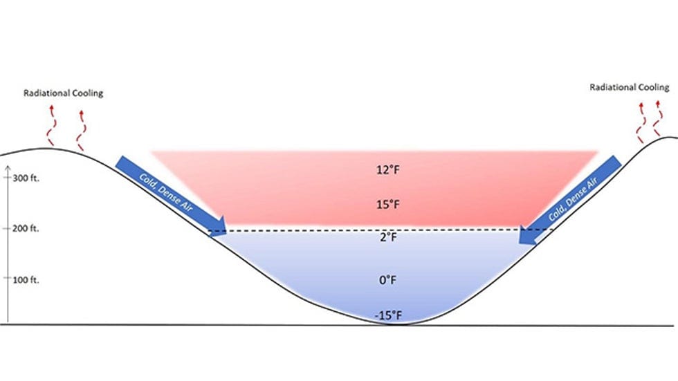
Below you can see the phenomenon know as a cold sink illustrated below. Cold air likes to sink down into different depressions in the landscape. This is often known by farmers as a frost hollow but Berks garden is basically a frost hollow on a much larger scale. This leads to the temperature differential not being that large, but compared to surrounding Tazwell county it is significant roughly around 10 degrees colder on average give or take.
Cold air tends to travel downstream over water, typically through rivers, streams, and creeks. Cold air will flow down from mountain tops and slowly flow out to sea, riding on top of the water. Usually, this will also lead to it collecting on the top of lakes and other water bodies. This is why the tops of lakes often freeze before the bottom. But in Burke's garden’s case, because there aren’t as many, very tall mountains in the region because of this not as much cold air settles in Burke's garden, it’s also quite a large area, leading to the overall effect being a little less notable. However, it still makes a significant difference in their winters. They receive higher-than-average snowfall and often experience some quite record-breaking ones.
Above you can see some historic images of some of the record-breaking snowfall that Burke's Garden can often get. In 1948, Burke's garden set the record for snowfall in Virginia. And in 1995-1996. Burke's Garden recorded 97 inches of snow. The largest snowfall in Burke's Garden history was the snowfall in 1977-1978, where 112 inches was recorded.
Sources/Citations
- Burke’s Garden by Louise B. Leslie and Dr. Terry W. Mullins