
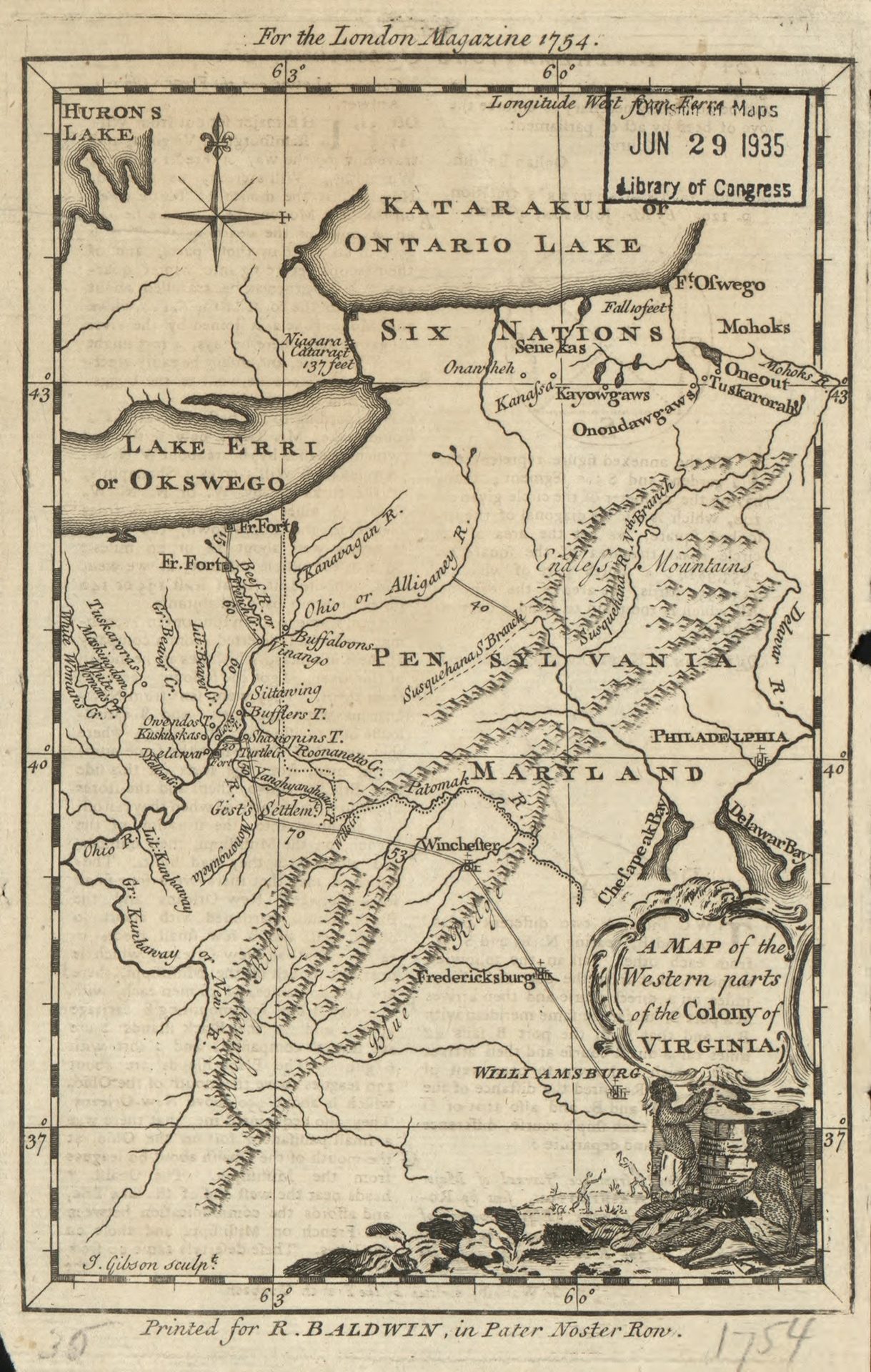
#1, 1754 Map of the Western Parts of the Colony of Virginia. New River and the Great Kunhaway rivers.
“Allegheny Ridge” marks the continental divide. In September 1671, Thomas Batte and Robert Hallam had arrived on what would then be known as Wood’s River and by 1754 is the New River. (Library of Congress)
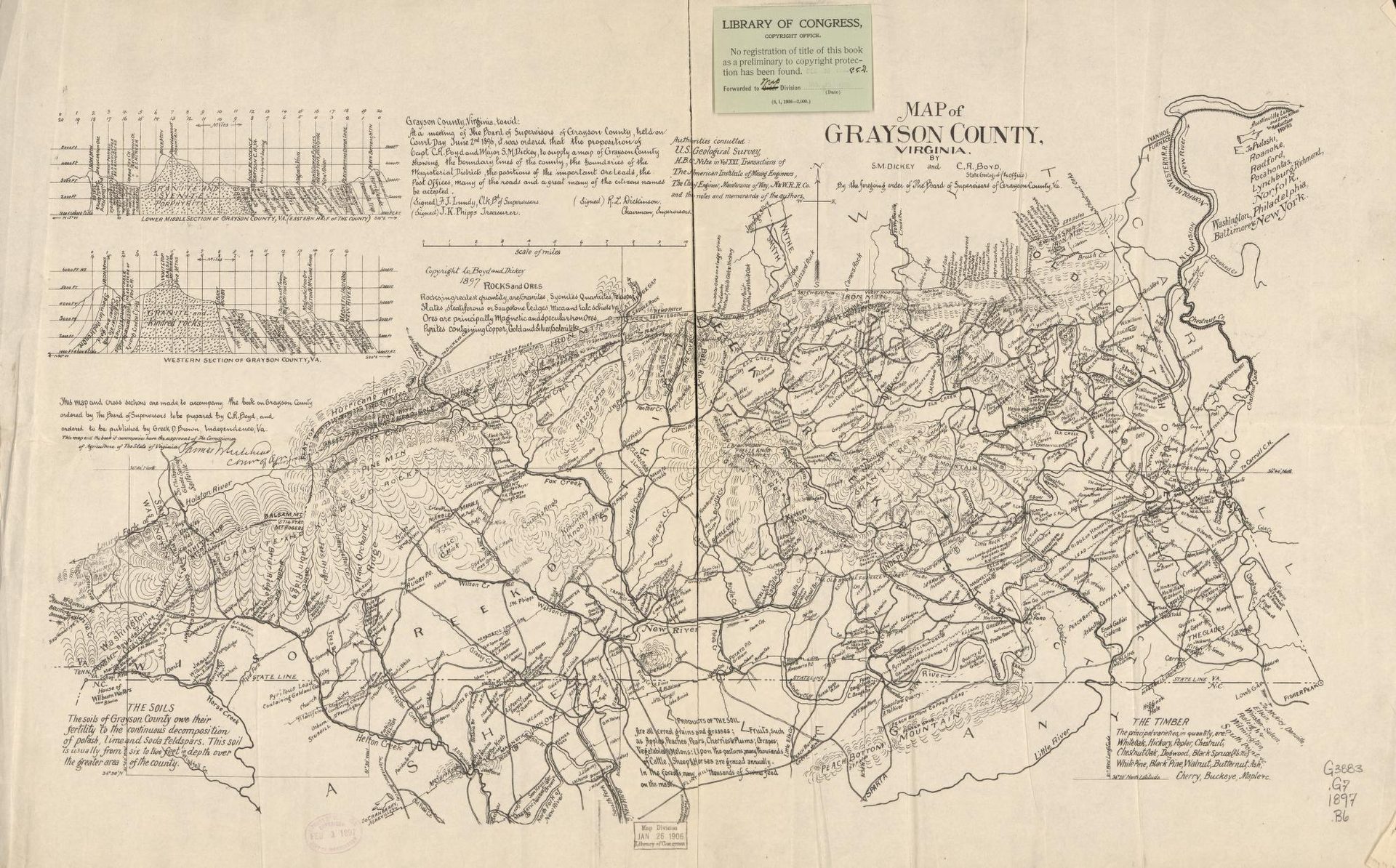
#2, 1896, Map of Grayson County, Virginia, S. M. Dickey, and C. R. Boyd.
Showing county lines, magisterial districts, post offices, roads, ore leads, soils, agricultural resources, and geographic features. Published by Grayson County Board of Supervisors. (Library of Congress)
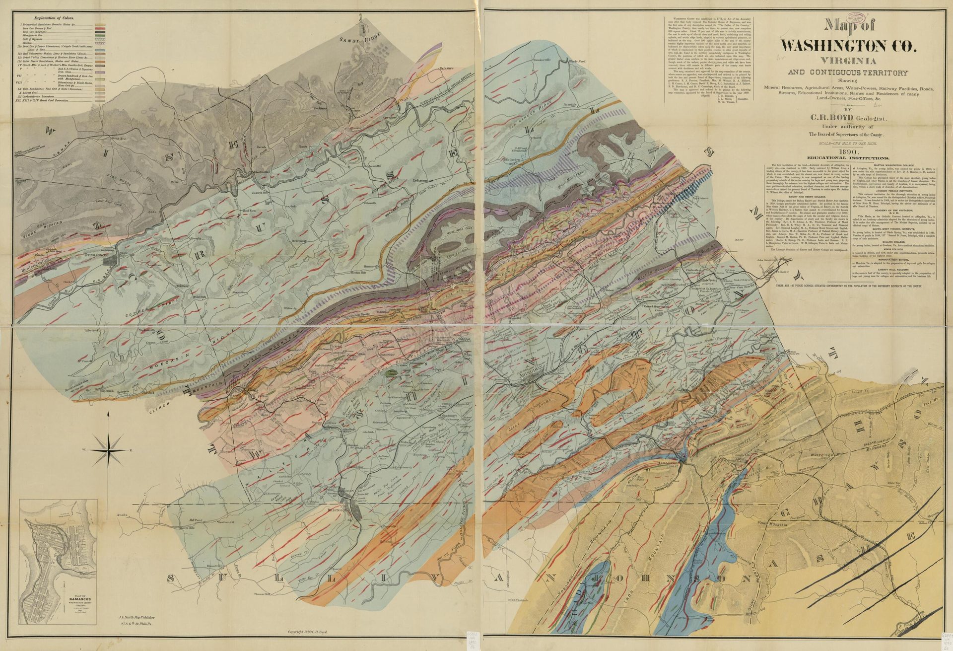
#3, 1890 Map of Washington County Virginia and Contiguous Territory, C. R. Boyd.
Showing mineral resources, agricultural areas, water power, railroads, public roads, post offices, and landowners. Also covers parts of Russell, Smyth, and Grayson counties. Published by Washington County Board of Supervisors. (Library of Congress)
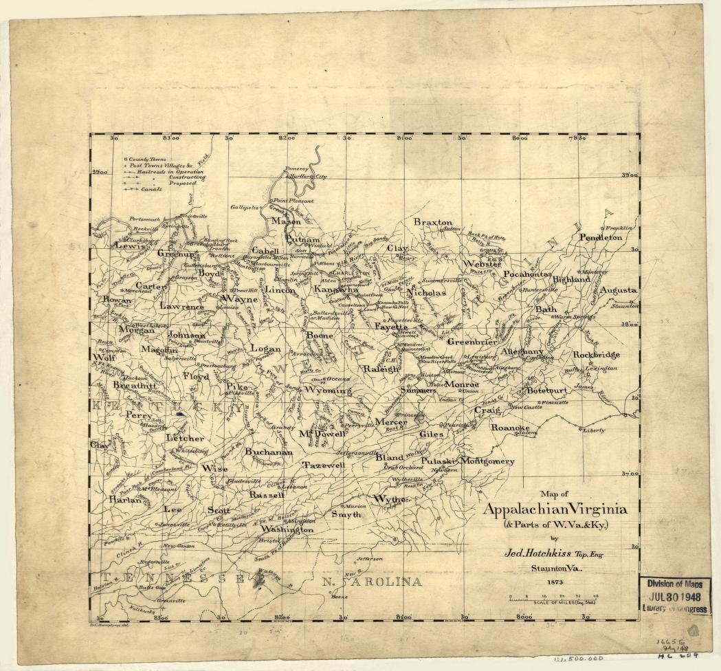
#4, 1873 Map of Appalachia Virginia and parts of West Virginia and Kentucky, Jedidiah Hotchkiss.
Produced by Jedidiah Hotchkiss, one of the earliest proponents of the development of the Southwest Virginia and southern West Virginia coalfields. Shows counties, towns, and settlements, and major rivers. (Library of Congress)
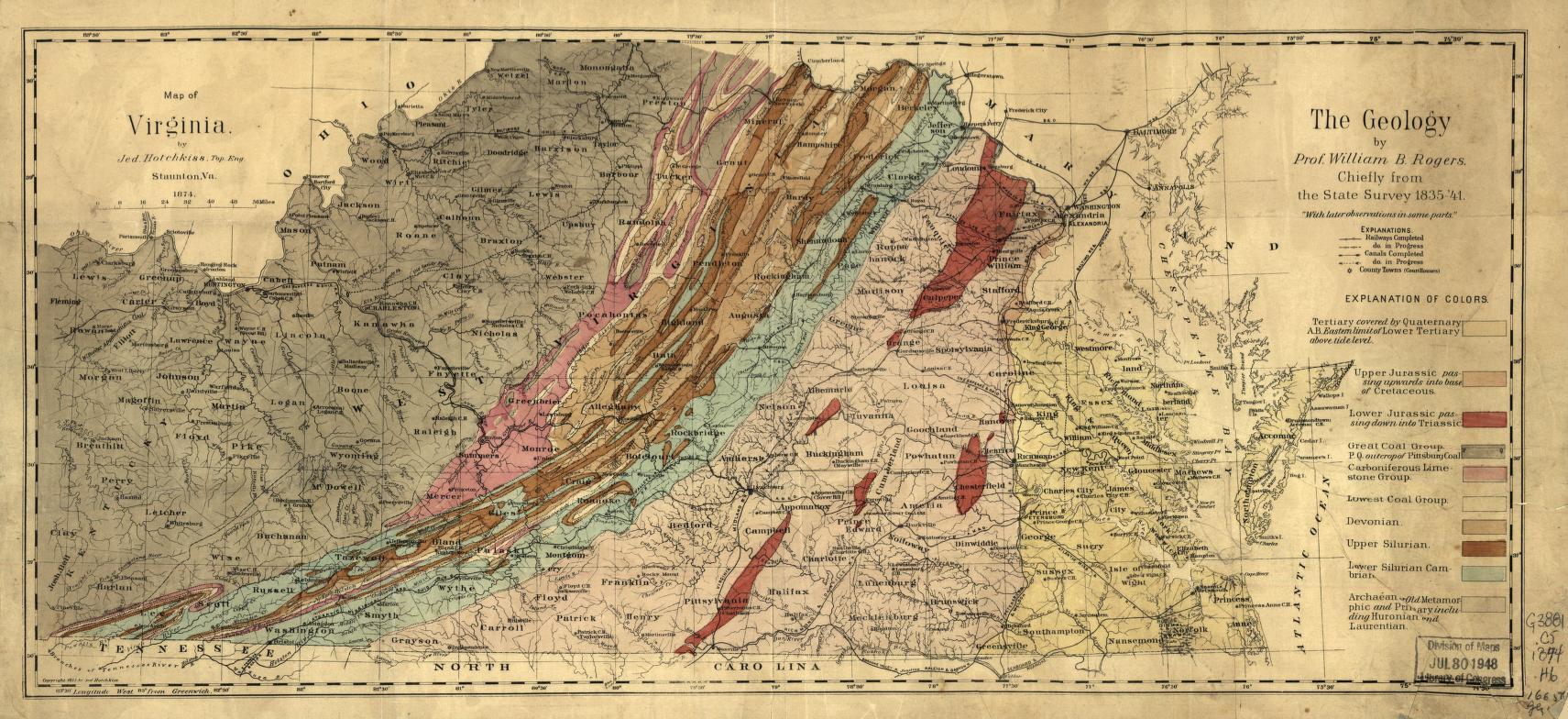
#5, 1873 Map of Virginia Geological Regions, Jedidiah Hotchkiss.
Showing geological regions of Virginia showing coal and iron regions in Southwest Virginia. (Library of Congress)
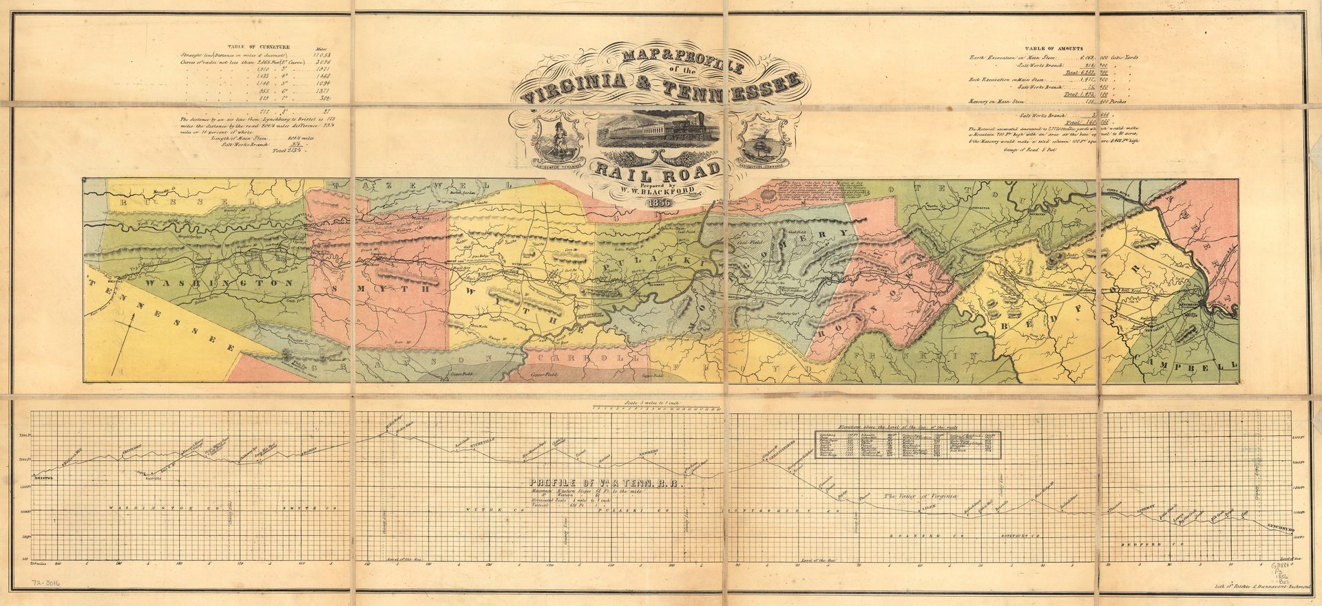
#6, 1856 Map and Elevation Profile of the Virginia and Tennessee Railroad, prepared by W. W. Blackford.
Route and elevations along the line of the Virginia and Tennessee Railroad, from Lynchburg to Bristol. (Library of Congress)